March Auction
Lot 25:
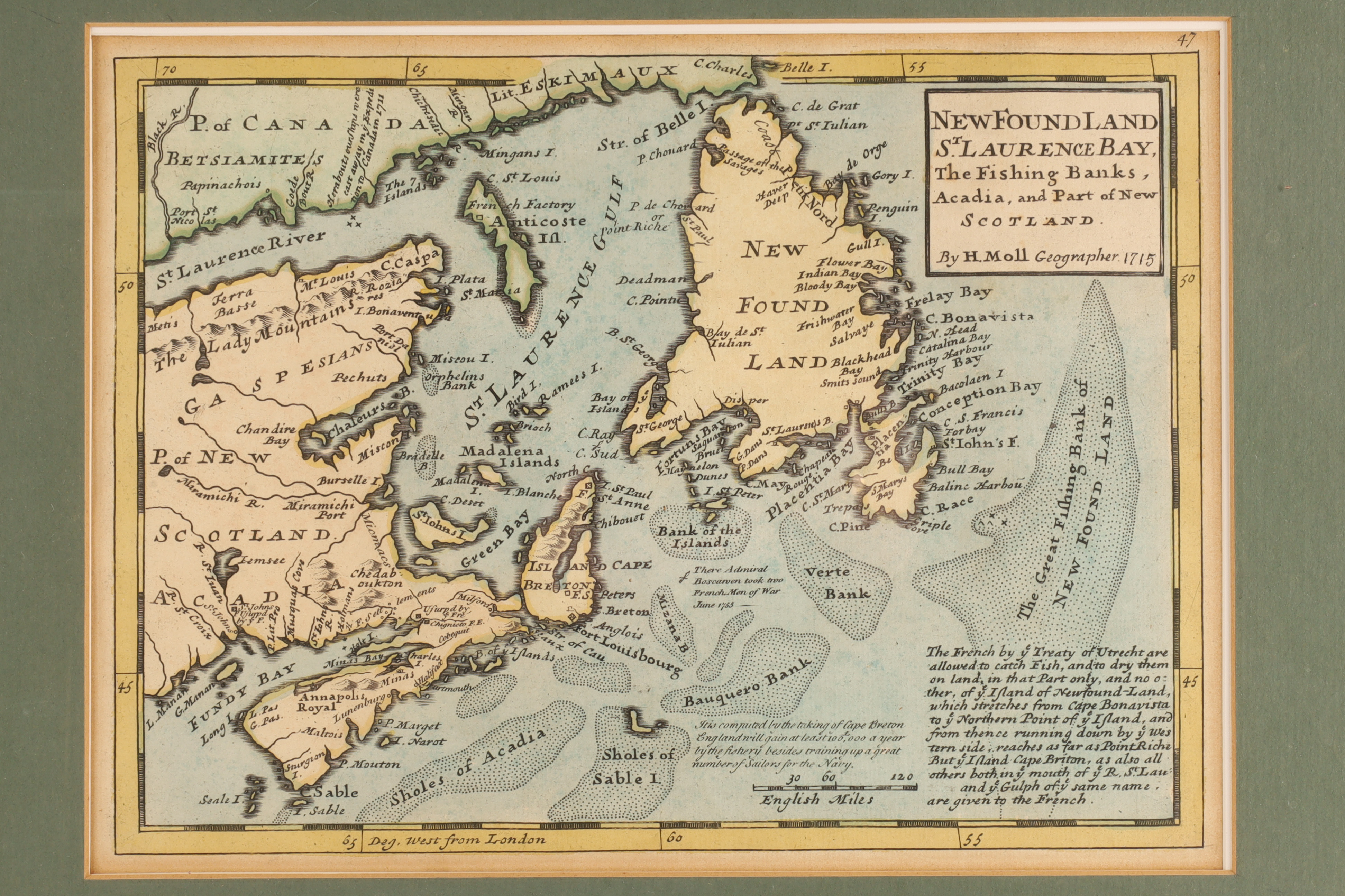
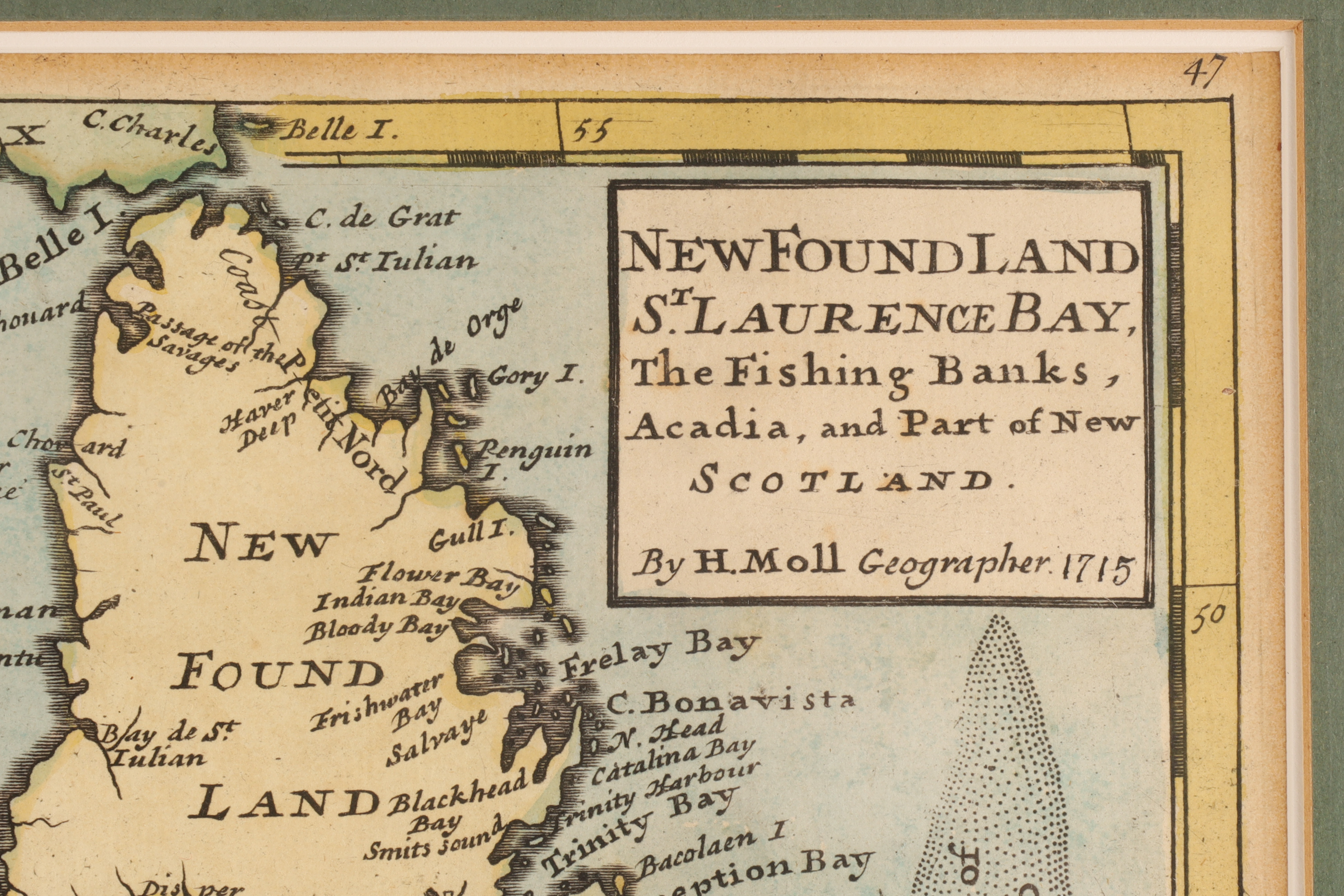
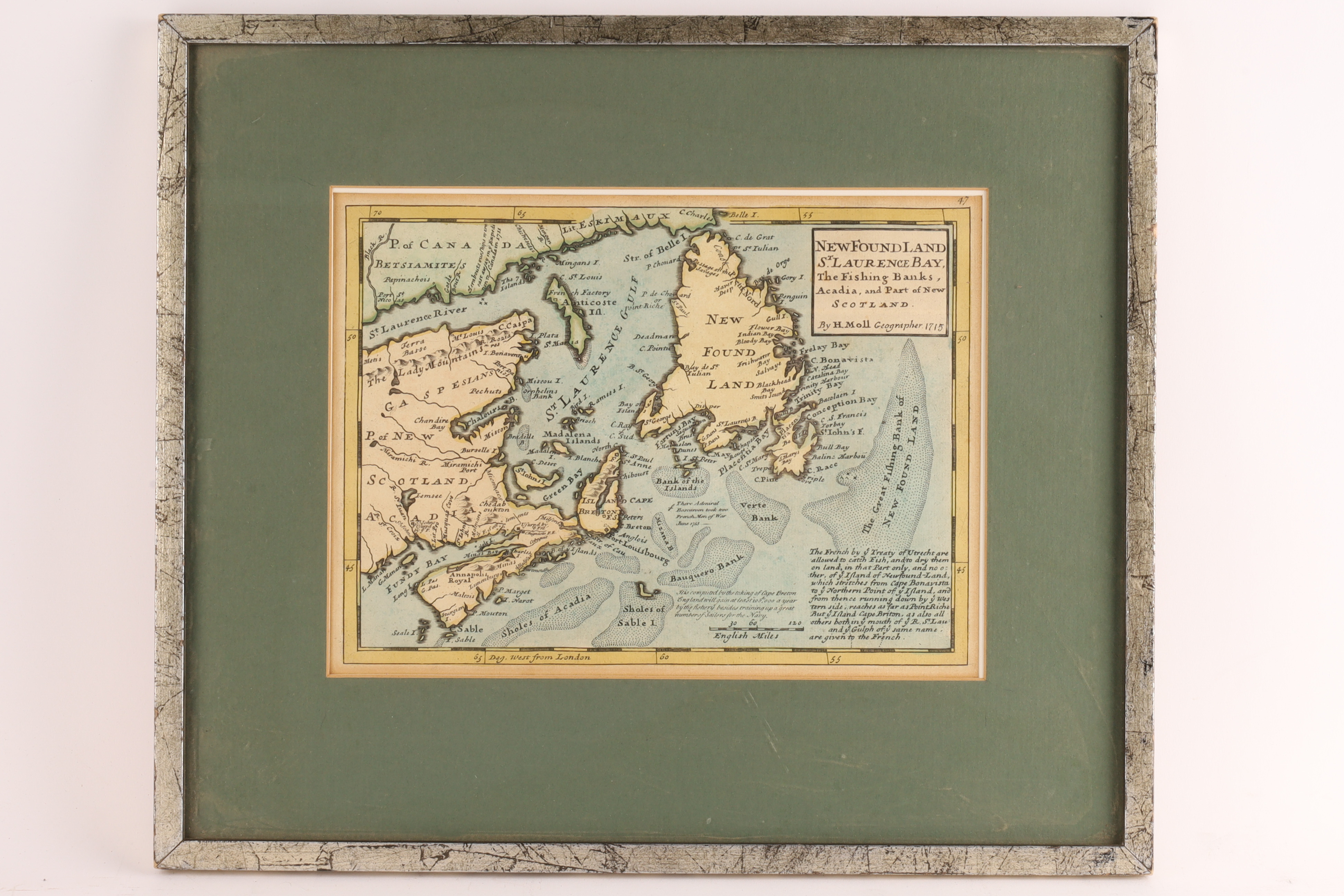
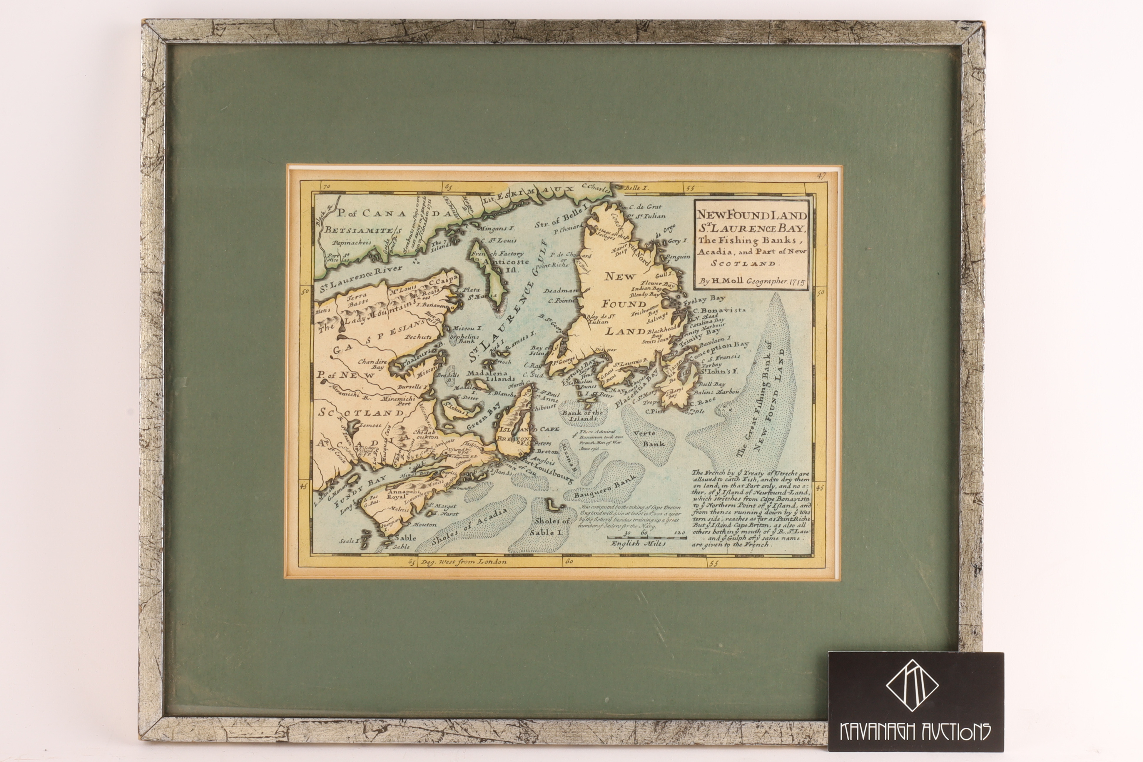
18th Century Map of Newfoundland and St. Lawrence Bay, H. Moll, Hand-Colored
Description
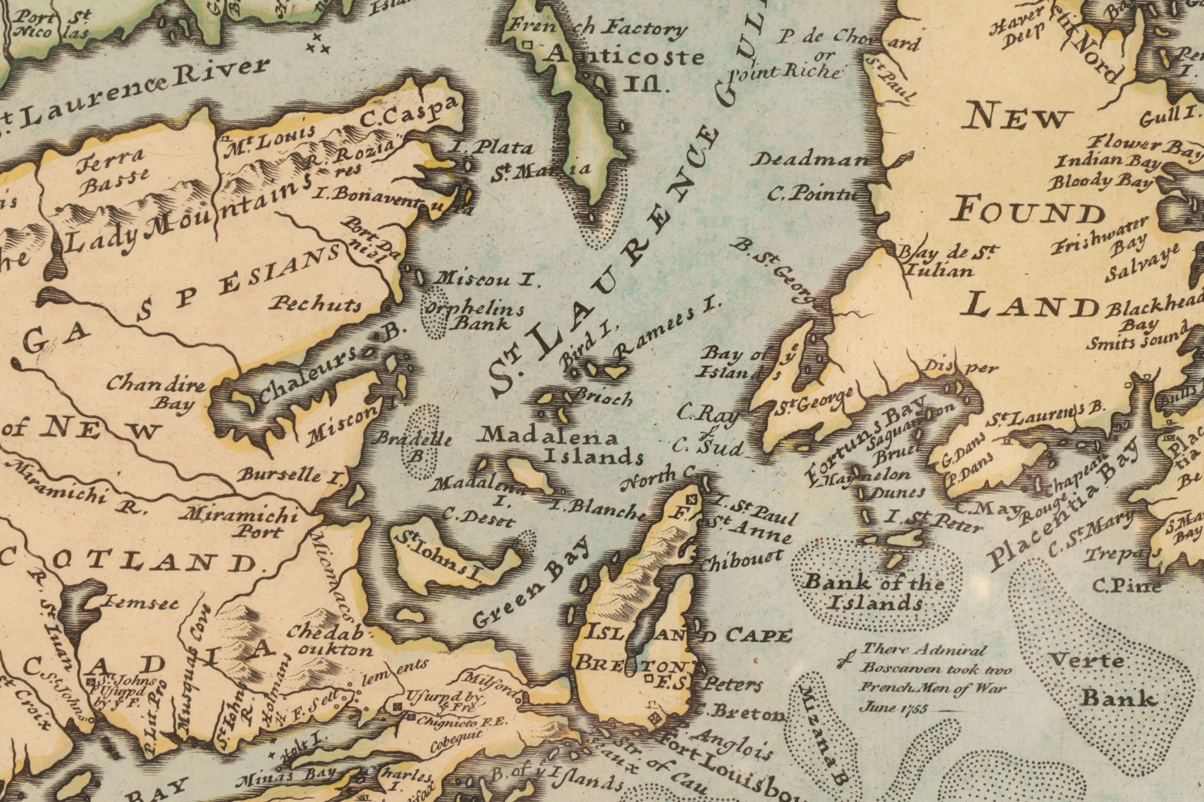
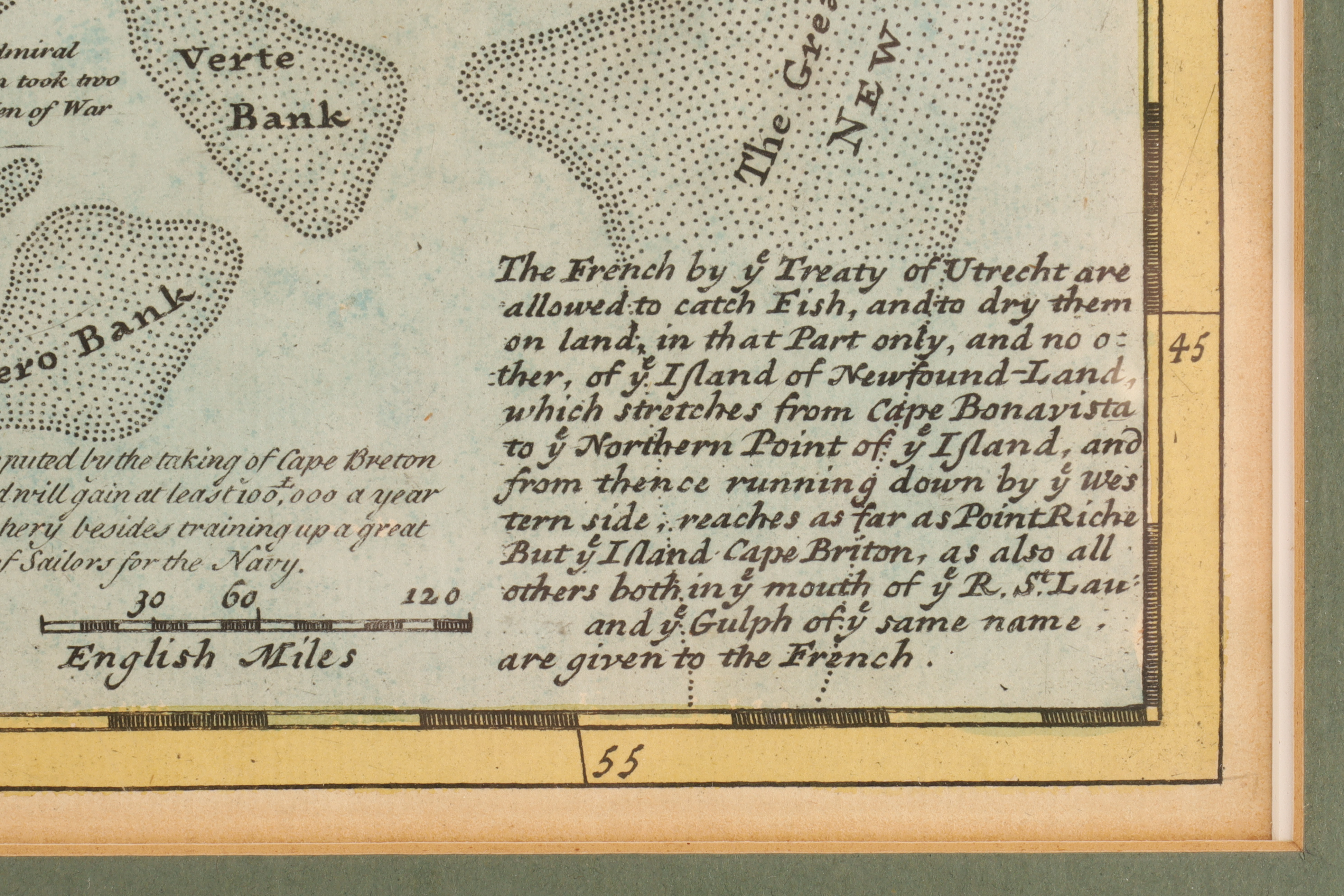
Hand-colored map titled “Newfoundland, St. Laurence Bay, The Fishing Banks, Acadia, and Part of New Scotland”, Herman Moll, originally published early 18th century. The map depicts Newfoundland, Cape Breton, Nova Scotia, the Gulf of St. Lawrence, and surrounding coastal regions, with detailed notations of fishing banks, shoals, and maritime routes.
The engraving features period cartographic typography, coastal soundings, and descriptive text blocks typical of early 18th-century English mapmaking. Regions are outlined in hand-applied color washes, emphasizing territorial divisions and coastal geography.
Presented under mat and glass in a decorative frame.
Details
Cartographer: Herman Moll (1654-1732)
Title: Newfoundland, St. Laurence Bay, The Fishing Banks, Acadia, and Part of New Scotland
Medium: Hand-colored engraving
Sheet size: approx. 11 x 8.5 in.
Frame size: approx. 17 x 14.5 in.
Share this lot: